Walks and Walking on Romney Marsh

You can view online and print Ordnance Survey maps showing public footpaths, cycle paths, bridleways and other rights of way; for walking, cycling, and outdoor activities. Just go to Footpaths Maps and enter the place or postcode of the area you wish to walk.
Appropriate postcodes are given below. To see the footpaths, shown as red dashes, zoom out (-) to level 7 or 8.
Brookland TN29 9RG Lydd TN29 9AJ
Burmash TN29 0JJ New Romney TN28 8BW
Dungeness TN 9NB Newchurch TN29 0DP
Dymchurch TN 29 0NH Old Romney TN29 9SQ
Greatstone TN 28 8SZ Snargate TN29 9UQ
Ivychurch TN29 0AL St Mary's Bay TN29 0SA
Littlestone TN28 8LS St Mary in the Marsh TN29 0BX

.
A walk through the Romney Marsh countryside, from St Eanswith Church in Brenzett to St Dunstan Church in Snargate.
You can visit the historic medieval churches and have refreshment in the Red Lion, an unspoilt, multi-room 16th century smugglers pub.
Approximately 2.7 miles over flat terrain.

The coastline of Romney Marsh extends from Hythe round Dungeness Point, some 20 miles of coastline. For the first time people have the right of access around all our open coast, including – where appropriate – ‘spreading room’ along the way where you will be able to rest, relax or admire the view.
The new path along the Romney Marsh coast forms part of the England Coast Path and generally follows the coast with the exception of diversions inland to avoid the Lydd and Hythe Army ranges.
There are also minor diversions at Dungeness, in order to protect the shingle vegetation, and Greatstone, to avoid exceptionally high tides.
You can find out more on our England Coast Path page
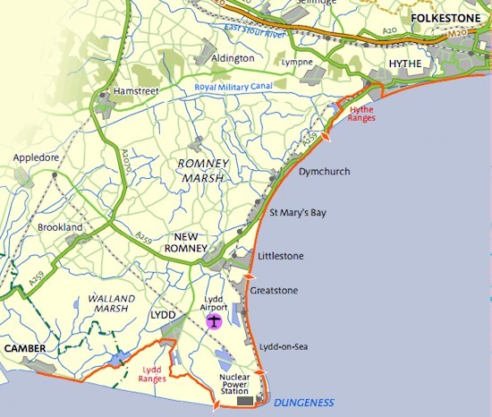
Proposed Coastal Path (September 2014)

There many areas to walk on Dungeness National Nature Reserve and a good place to start is at the car park just opposite The Old Lighthouse and RH&DR station.
From the car park walk northwards away from the lighthouse. There are a number of footpaths that you can follow, providing short, medium and long walks. For a walk of about 1½-2 hours continue walking south until you almost reach Dungeness Road [running south east to north west] turn left and make your way westward until you reach the lakes, turn right and then return southwards back to the car park.
Other Dungeness walks are:
![]() Dungeness Trail - taking in the Old Lighthouse, shacks and railway carriages on beach and Derek Jarman's Prospect Cottage
Dungeness Trail - taking in the Old Lighthouse, shacks and railway carriages on beach and Derek Jarman's Prospect Cottage
![]() Dungeness Walk by Lou Johnson - a 7 mile walk taking in the RSBP Reserve and the Old Lighthouse.
Dungeness Walk by Lou Johnson - a 7 mile walk taking in the RSBP Reserve and the Old Lighthouse.
![]() RSP Dungeness Nature Reserve Circular Walk
RSP Dungeness Nature Reserve Circular Walk
RSPB Dungeness Nature Reserve Circular Walk - an approximate 2 mile loop trail located on the reserve that offers the chance to see wildlife and is good for all skill levels. The trail is primarily used for hiking, walking, running, and bird watching.
NB Some of the walks will be on shingle.
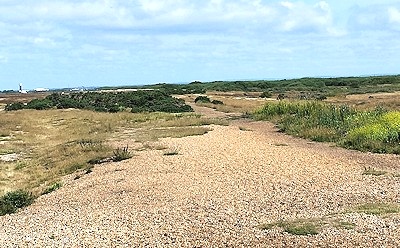
View from the car park at Dungeness

Adjacent to the beach and sea, the dunes at Greatstone, a Site of Special Scientific Interest, provide walks amongst the flora and fauna, including some rare species, of this part of the coast.
You can start your walk from either of the two public car parks in Greatstone, in Coast Drive opposite to Clark Road and in The Parade, with its entrance opposite to the Post Office
From the Coast Drive car park, walk south past the lifeboat station for access to the dunes. From The Parade car park, take the north footpath to the beach, turn left (north) and the dunes are a couple of hundred yards on the left.
For more information and the sand dunes, please visit our Greatstone Sand Dunes page.
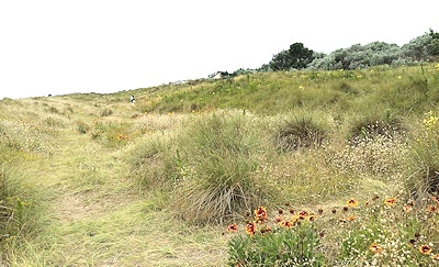
Greatstone Dunes

This is a walk of just over 2 miles (there and back) alongside Greatstone Lakes, following the track of the now disappeared Southern Region railway line.
You start the walk at the west end of Taylor Road in Lydd-on-Sea. There is a car park at the east(sea) end of Taylor Road and the 102 bus route has stops there. From the west end of Taylor Road, continue westwards across the shingle until you meet the footpath on what used to be the old railway track. From here, turn north and the walk takes you alongside both the south and north Greatstone Lakes
You can see the three Sound Mirrors on the opposite side of the south lake. You can get a closer view of the mirrors by turning northwards, following the sign postfor the mirrors, along a shingle path which runs between the two lakes.
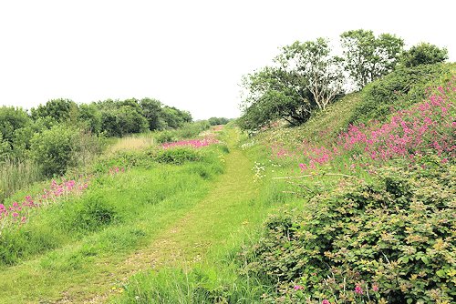
Walking north with the lakes on the left

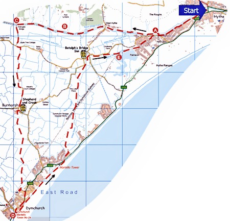
Hythe, Romney Marsh & Dymchurch Walk
This is a circular walk of just over 10 miles (about 5 hours) which starts and ends at the Royal Military Canal at Hythe. The walk can be shorted to 6 miles (3 hours) by taking the bus or train (RH&DR) back from Dymchurch to Hythe.
The walk follows the route of the military canal westward as far as Aldergate Bridge, where you turn southwards through Burmarsh to Dymchurch.
The return route is along the Dymchurch Wall, passing the Martello Towers before taking the road northwards to Botolps Bridge. At the bridge you turn eastwards back to Hythe, passing the Nicholl’s Quarry Lake.
Refreshment on the way can be had at the Shepherd and Crook in Burmarsh, pubs etc in Dymchurch and Botolp's Bridge Inn.
OS Map: Explorer 138 (Start at grid reference TR154347)
You can get full details of the walk and a larger scale map at the Kent Ramblers website.

Walk taken from Kent Dog Friendly Pub Walks 2019: 20 Dog Walks
Starting at The Bell Inn, you'll discover a proper community pub which has won many CAMRA awards.
St George Church forms an impressive backdrop to the large and well cared for beer garden. Dogs are welcomed inside on the tiled area provided they don’t get on the furniture.
How to get there: From the M20 Junction 10 follow the signs for the A2070 and Brenzett. Once the A2070 has dropped onto the Romney Marsh after Ham Street, follow the sign left for Ivychurch.
The Bell pub is on the left-hand side as you enter the village. Sat Nav TN29 0AN.
Terrain: Although totally flat the paths can be indistinct in places and very uneven, making this a surprisingly challenging walk. Recommended only for fitter dogs and owners. Not suitable for small dogs. Some of the paths are rarely used, one of the attractions of this walk, so be prepared for some vegetation encroachment in summer.
There is a little road walking to start, and a stretch along a very empty lane towards the end.
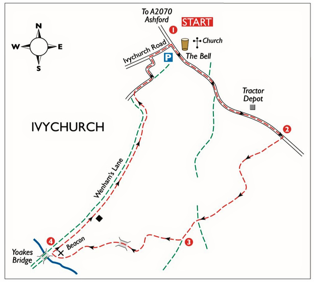

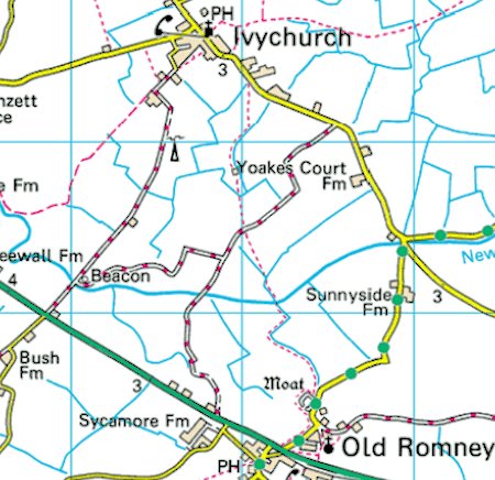
This walk of about 3 miles (1½hours) starts and finishes in Ivychurch. With St George Church on your left, walk along the road, pass the phone box, then take the footpath on the right. Go diagonally left across this field - keeping the mast on your right. Walk around the edge of the next field, cross over a bridge and continue until you reach Yoakes Lane. At the lane, turn right and follow it all the way to Old Romney.
At Old Romney you come to the busy main road (A259), turn left here and walk down, before turning left again into Five Vents Lane, with St Clement Church on your right as you turn into the lane.
There is now a choice of routes. You can follow Five Vents Lane all the way back to Ivychurch, or go up the lane, walk around a curved medieval moat and follow the ditch, walking around the field edges and crossing two bridges, to arrive back at Yoakes Lane. You can retrace your steps to reach the village, or turn right and continue along Yoakes Lane to the main road. When you reach the road, turn left and walk back to the Bell Inn and your starting point.
OS Map: Explorer 138 (Start at grid reference TR 028277)
You can get full details of the walk and a larger scale map at the AA website.

The Romney Warren Country Park, with the Romney Marsh Visitor Centre, is located to just north of New Romney on the A259 Dymchurch Road. ![]() location map.
location map.
Romney Warren Country Park is a natural wooded oasis for insects, wildflowers and small animals set in 11 hectares of unspoiled dune grassland, willow scrub and ponds rich in wildlife, all of which can be explored via its three walking trails.
There are three walking trails - Dragonfly, Rabbit and Sheep - which start from the Visitor Centre. The Dragonfly Trail (red on the picture), 0.2 mile, is fully accessible for all users including wheelchairs. The Rabbit Trail (blue on the picture), 0.4mile, is not suitable for wheelchairs because of the soft sandy soil. The Sheep Trail (white on the picture) is about 1 mile.

Download the Romney Warren Country Park leaflet, which includes the map above.

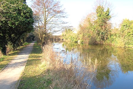
There are numerous public footpaths that cover the Marsh. One of the most attractive walking areas is alongside the Royal Military Canal. The Royal Military Canal is a canal running for 28 miles (45 km) between Seabrook near Folkestone in the north east and Cliff End near Hastings in the south west, following the old cliff line bordering Romney Marsh.
The Royal Military Canal Path runs along the entire length of the Royal Military Canal from Seabrook, Kent to Cliff End in East Sussex. The route treads a path between the vast openness of the Romney Marsh and the old cliff line with its wooded hills and quiet villages.Walking along the quiet canal banks today it is easy to forget that this was once the scene of intense military activity. Now, much of the drama on the canal comes from the variety of wildlife that has made the canal its home.
Many public footpaths link to the Royal Military Canal Path, so it is easy to plan circular routes that take in sections of the canal. For those who prefer to stay close to the water, you can walk the length of the canal in stages.

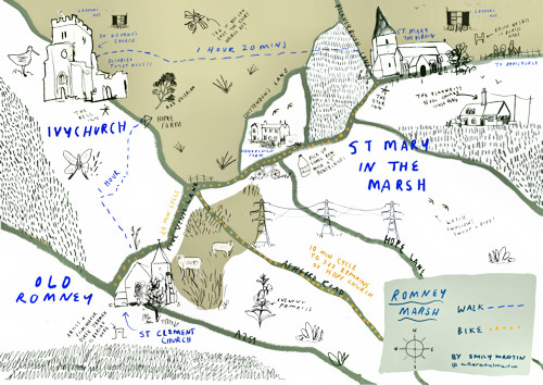
You can explore St Mary in the Marsh, Ivychurch, and Old Romney accompanied by an audio trail. Enjoy this unique landscape through the eyes of those who have described, painted, filmed, written poetry, and explored Romney Marsh with such detail.
The trail can be short ambles around the churchyards to full-scale rambles across the marsh. Drive, cycle or walk, you choose.
For optimum listening experience, download the audio and find some headphones before you set off, so it’s ready for you to enjoy when you arrive at your destination.
You can find out more about the trails and download the accompanying audios from the Art in Romney Marsh Website.

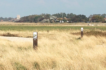
The Dungeness National Nature Reserve provides a completely different walking experience, with its wide open spaces and shingle banks.
The Greatstone Shingle Trail is a short walk that takes you along the tideline on Greatstone beach towards Greatstone car park, then across to a small part of the Dungeness National Nature Reserve, before coming back along part of the beach.
You can get full details of the walk and a larger scale map at the Shingle Trail web page.

Discover the stories of the ancient Romney Marsh towns of Lydd and New Romney by following their Town Trails. Each walk lasts about 30 minutes and take in some of the historical stories of each town.
Just click on the links below for full information about each of the two trails, including maps.
![]() Lydd Town Trail
Lydd Town Trail
![]() New Romney Town Trail
New Romney Town Trail
New Romney History Walk
Discover more about the town of New Romney and its unique Norman history by following a ![]() Norman Walk in New Romney.
Norman Walk in New Romney.
Guided Walk of Lydd
Guided walks of Lydd explaning its history take place on Wednesdays in August and September 2016. Find out more.
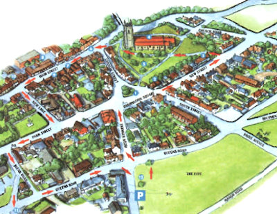
Lydd


