Lydd History

Lydd developed as a settlement during the Romano-British period on a shingle island when the coast at the time cut off Lydd from the mainland. The settlement continued into the Saxon period, with the Saxon church using Roman materials as part of its early construction.
The town reached the height of its prosperity during the 13th century, when it was a corporate member of the Cinque Ports, as a "limb" of Romney. As with much of the Marsh, the town was a base for smuggling in the 18th and 19th centuries.
Lydd gave its name to Lyddite, a form of high explosive widely used during both the Boer War and First World War, most notably during the latter by the British. Lyddite, composed of molten and cast picric acid, was first tested at the military camp in Lydd in 1888.
Lydd was at one time a garrison town and the area is still used as a military firing range for the armed forces with Lydd Ranges is a south of Lydd, in Kent, England. It extends as far as the coast. Because the range is used for live firing, access is sometimes restricted - red flags are flown during these times, access is prohibited along the foreshore and Galloways Road. The Danger area extends out to sea and mariners sailing to and from Rye Harbour must pass south of the Stephenson Shoal to avoid it.
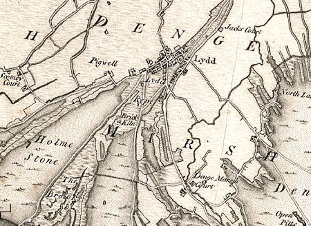
Map of Lydd in 1816
Located in the centre of the town, Coronation Square, overlooked by All Saints Church, housed stables when it was known as Wheeler's Green. A half-timbered house on the edge of the square is still known by this name. The name of the square was changed to Coronation in 1901 to commemorate the coronation of Edward VII.
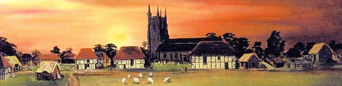
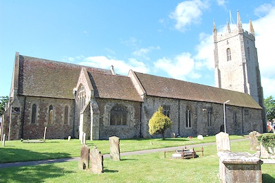
All Saints Church, also known as Lydd Church, was long thought to be Saxon in origin, but recent studies have dated the oldest section to the latter half of the 5th century, making it Romano-British.
The church is thought to incorporate a small Romano-British basilica possibly built in the 5th century, though most of the current fabric is medieval. The small basilica had an apse, an arcade on the north side of three bays, and an elaborate porch on the west side. This is considerably different from Anglo-Saxon churches, leading to a Romano-British attribution. Find out more
In 1870-72, John Marius Wilson's Imperial Gazetteer of England and Wales described Lydd as follows:
LYDD, a small town, a parish, and a sub-district, in Romney-Marsh district, Kent. The town stands near the coast, 3½ miles SW by S of New Romney, 4 NW of Dungeness, and 7½ SW of Appledore r. station; is a member of Romney cinque-port, and a borough by prescription; is governed by a bailiff, jurats, and freemen, -the bailiff and jurats elected annually; is a seat of petty sessions; had, till recently, a weekly market; and has a post office‡ under Folkestone, a neat market-house, a church, a Wesleyan chapel, a national school, breweries, and a fair on the last Monday of July. ...
The church is later English, and large; has a lofty handsome tower, supposed to have been erected by Cardinal Wolsey, who held the benefice in right of the abbey of Tintern; contains an altar-tomb to Sir W. Meynell of the time of Edward III., and a number of brasses; and was given, by one of the De Clares, to Tintern Abbey. The parish comprises 11,788 acres of land and 1,715 of water. Real property, £16,889. Pop. in 1851,1,605; in 1861, 1,667. Houses, 360.
The land is of various character; a great portion appears to be of more recent formation than the adjacent marshes; and parts called the Rype and Midrips, run out in narrow tongues; yet reaches of the beach are suffering inroads by the sea, and are cut by it into pits or water-holes. A long track, called the Holmstone, was once covered with sea-holly, locally termed holm, and of an unusual size.
A heap of stones, at Stone-end on the shore to the E of the town, was long traditionally regarded as the tomb of Sts. Crispin and Crispianus, who were alleged to have been shipwrecked and buried here. The living is a vicarage in the diocese of Canterbury. Value, £1,450.* Patron, the Archbishop of Canterbury. Charities, about £130. See DUNGENESS.—The sub-district contains also seven other parishes. Acres, 26,114. Pop., 2,826. Houses, 593.
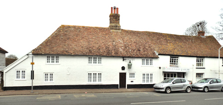
The Beehive
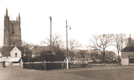
Coronation Square c?
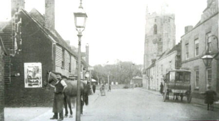
Lydd Hight Street 1911

