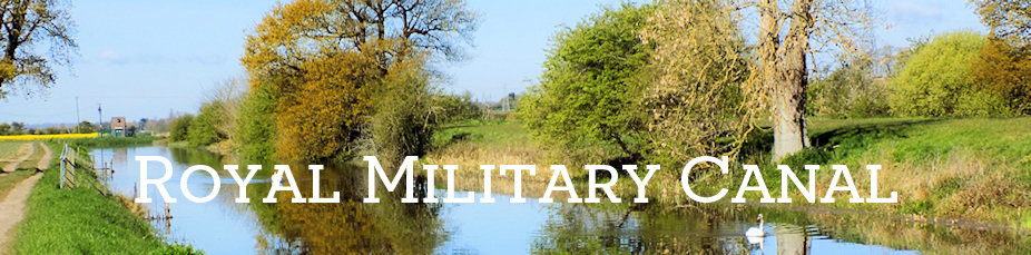
Royal Military Canal
The Royal Military Canal was a massive coastal defence work constructed between 1804 and 1809. Its purpose was to separate the expected landing and deployment of Napoleon's troops upon the coast of Romney Marsh from the interior of the country. The canal runs for 28 miles from Seabrook nr Hythe through Romney Marsh to Cliff End nr Hastings in East Sussex. After Hadrian's Wall and Offa's Dyke, it is the third longest defensive structure in the UK
The Government initially considered flooding the marsh but favoured the canal, which was the idea of Lt. Col. Brown, the Assistant Quartermaster-General. He carried out a survey and work commenced in 1804 at the height of the invasion scare, with John Rennie as consulting engineer (until 1805). The canal ran a total of about 28 miles from Shorncliffe Camp via Hythe inland to Appledore, to join the Eastern River Rother at Iden lock, from where it became part of first the Rother and then the River Brede, turning into a canal again from Winchelsea to Cliff End on the coast.
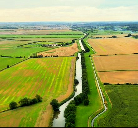
Excavated earth formed the banquette and parapet on the landward side of the canal and behind this was an army supply route, the Royal Military Road. On the opposite side were the tow path and wharves. It also included a back and a front drain. The canal and parapets were so built that gun positions could be provided at the end of each length to flank the crossings. However by the time the canal was completed in 1809, the threat of invasion had passed, following Napoleon’s defeat at the Battle of Trafalgar, and it was to some extent obsolete.
In 1810, the canal was opened for public use and tolls were also collected for use of the Royal Military Road. In the later 19th century public use declined. The last toll was collected at Iden Lock in December 1909. Today Iden lock is a sluice, so the main part of the canal is isolated. The eastern section of the canal is still in use for pleasure boats.
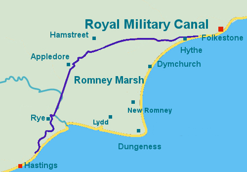
The route of the canal
The Royal Military Canal was an important element in the Napoleonic defences of south-east England and is the only military canal in the country. It is a unique defensive work that bears significant testament to a period when modern Britain faced the most serious threat of invasion prior to the major conflicts of the 20th century.
The 1.44km length of the Royal Military Canal running from Bonnington Bridge to Gigger’s Green Bridge survives well. It includes some well preserved original features such as the parapet, the Royal Military Road and the back drain. The canal will contain archaeological information relating to its construction and use.
The Second World War pillboxes are also of archaeological and historic significance. Pillboxes are small reinforced concrete or brick buildings of a diversity of shapes and forms, designed to house either infantry, anti-tank guns or field artillery. Some World War I examples survive in eastern and southern England, but pillbox construction mainly dates from late May 1940 as part of the rapid programme of anti-invasion defences initiated after the fall of France.
Design principles born from the practical experience of British troops in France, led to a shell-proof concrete construction whose loopholes or embrasures in each facet gave all round cover. During the Second World War, they were located alongside other defensive structures either at vulnerable or strategically important nodal points, along the coast, on the communications network, around vital installations such as airfields, or arranged in linear defensive systems called Stop Lines that were intended to obstruct the enemy's advance. These examples on the Royal Military Canal are sited in a strategic position, with the canal serving as an obstruction to the enemy.
Source: Historic England
The canal showing its 'double bends' (Ack. 42)
