England Coast Path
The England Coast Path is a new National Trail all around England's coast. It is opening in sections and will be complete in 2020, and when it is complete it will be be one of the longest coastal walking routes in the world. The Romney Marsh section opened in July 2016 and can be accessed anywhere along its route.


The coastline of Romney Marsh extends from Hythe round Dungeness Point, some 20 miles of coastline and includes sand dunes, sandy and shingle beaches, with much of it within the Dungeness National Nature Reserve. Almost the entire coastline is protected by concrete wall and shingle sea defences.
For the first time people will have the right of access around all our open coast, including – where appropriate – ‘spreading room’ along the way where you will be able to rest, relax or admire the view. The new right of access will be brought into effect at different times around the coast.
Natural England produced detailed plans (see below) of the new path along this stretch of the Kent coast between Camber and Folkestone. The section around the coast of Romney Marsh was opened in July 2016.
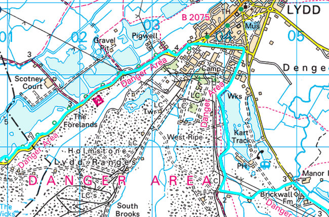
The path generally follows the coast with the exception of diversions inland to avoid the Lydd and Hythe Army ranges.
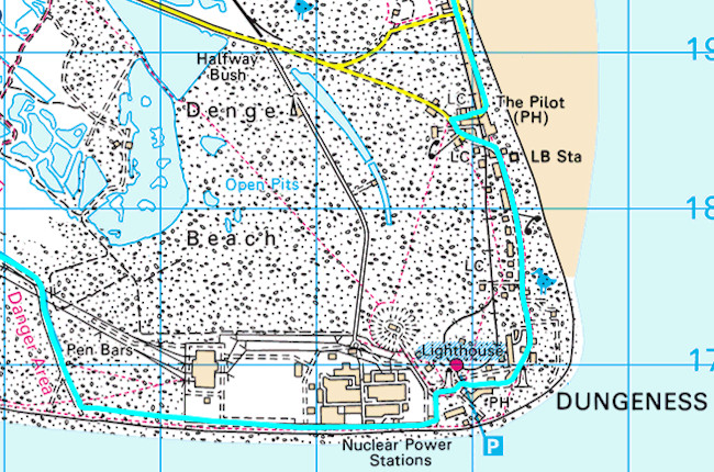
There are also minor diversions at Dungeness, in order to protect the shingle vegetation, and Greatstone, to avoid exceptionally high tides.
The new path makes the following key improvements to the existing arrangements for access to this part of the coast:
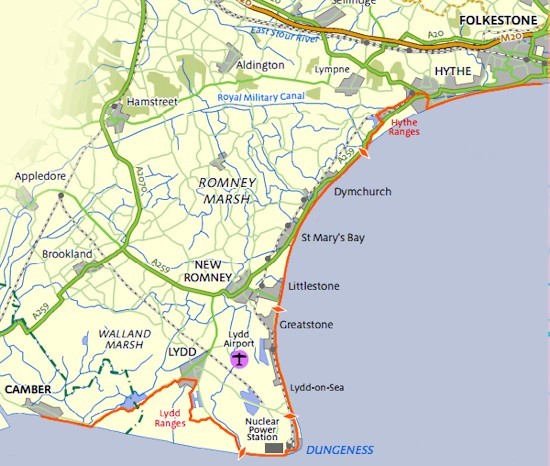
England Coast Path (detailed maps below)
- New sections of coastal path have been created in strategic places to link existing coastal rights of way into a continuous route along this stretch of coast for the first time;
- New sections of path through Hythe and Lydd have been created to provide a new and continuous route around the two large, predominantly inaccessible military ranges on this coast. These routes provide a valuable link into both towns, and utilise the attractive Military Canal route through Hythe;
- New access management measures have been implemented in the Dungeness area to clarify the use of the area, reduce impacts from visitor pressure and enhance visitor experience;
- For the first time, there are secure statutory rights of public access to most areas of beach and other coastal land on this stretch of coast;
- The coastal path is able to ‘roll back’ as parts of the low lying coast erode or change, ensuring the maintenance of a continuous route on this stretch of coast.
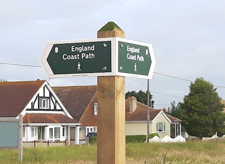
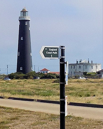
Typical Coast Path Signage
Royal Military Canal and Dymchurch Redoubt
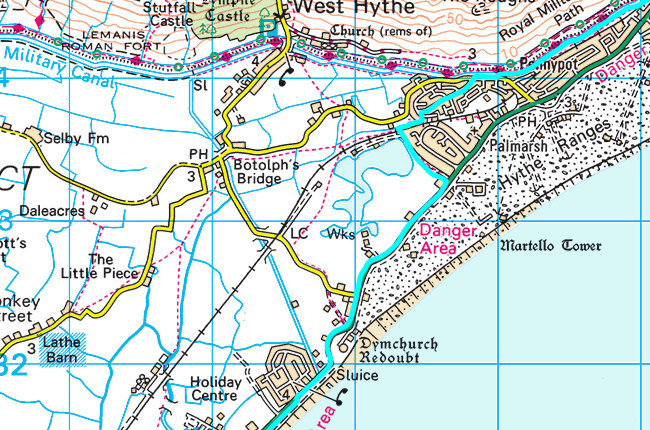
On leaving Hythe, the path follows the Royal Military Canal to avoid Hythe Ranges. After a short distance the path leaves the canal, turning eastwards to rejoin the coast just after Dymchurch Redoubt.

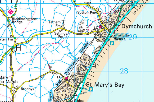
Follows the coastline line closely by Dymchurch and St Mary's Bay, maintaining good sea views and views of the Martello Towers and the Dymchurch Wall. Depending on the state of the tide, you can walk along the beach and/or the wall.

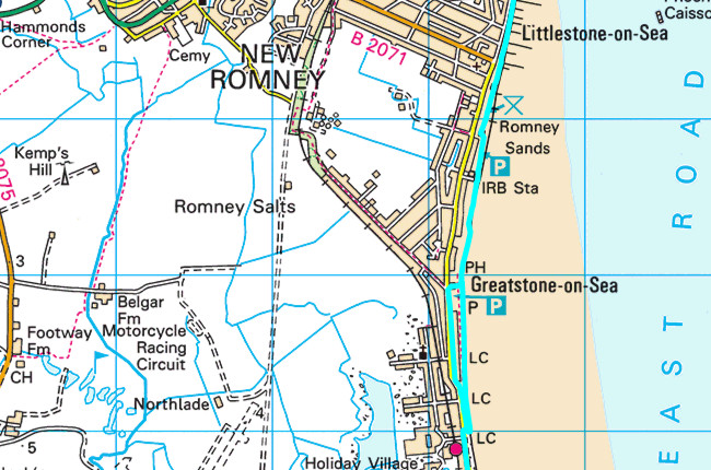
Mainly follows the coastline past Littlestone and Greatstone, quite closely and maintains good views of the sea. Depending on the state of the tide, you can walk along the sea wall, Greatstone Sand Dunes and Greatstone Beach.

Mainly follows the coastline and provides views of Lydd-on-Sea and Dungeness, including the two lighthouses, the RH&DR and the powers stations.

A diversion away from the coastline via the ouskirts of Lydd is necessary to bypass the Lydd Military Ranges. Along some of this inland route, there are distant sea views, and the coastal nature of the area is still evident at a significant distance from the shoreline, due to the unique landscape of vegetated shingle.
These maps have been taken from the Interactive Map on the National Trails website, where you can plan where to walk along the Romney Marsh Coast.
Places with Parking to Access the Path
Dymchurch - there are two car parks in Dymchurch just minutes from the path. Find out more
St Mary's Bay - there is a large car park adjacent to the path at St Mary's Bay. Find out more
Greatstone - there are two large car parks adjacent to the path in Greatstone. Find out more
Lydd-on-Sea - there is a small car park adjacent to the path at Lydd-on-Sea. Find out more
Dungeness - parking at Dungeness is not allowed on the shingle. There is a large car park adjacent to the path by the Old Lighhouse. Find out more
The England Coast Path is a significant step to improve public access to this stretch of coast in these ways, with benefits for residents, businesses and visitors. It will be managed as part of the family of National Trails.
Access, Restrictions and Exclusions
You can find out about Access, Restrictions and Exclusions for any part of the path by going to Natural England's Map Search and entering a place name or postcode.
Dungeness
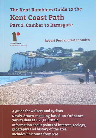
The Kent Ramblers have produced an excellent book titled The Kent Ramblers Guide to the Kent Coast Path: Part 1 (Camber to Ramsgate).
Click on the link to purchase the book online or you can buy it locally at the Romney Marsh Visitor Centre.
You can also find out more about the England Coast Path at the Natural England website.
![]() Walks and Walking
Walks and Walking
![]() See and Do on Romney Marsh
See and Do on Romney Marsh
![]() Visitors Homepage
Visitors Homepage
