


Dungeness Batteries

Given its closeness to the continent, the flat hinterland and easily accessible beaches, Romney Marsh has always been vulnerable to attack from across the English Channel, and the threat of invasion from Napoleon was no exception.
Napoleon Bonaparte (1769 – 1821), who was Emperor of the French from 1804, is best remembered for his role in the wars led against France by a series of coalitions, the so-called Napoleonic Wars. Due to his success in these wars, often against numerically superior enemies, he is generally regarded as one of the greatest military commanders of all time, and his campaigns are studied at military academies worldwide.
At the end of the 18th century the revolution in France had turned all of Europe into turmoil and Britain had become embroiled in war against France. After Napoleon had invaded the Low Countries in 1793, Britain feared we would be next, with Napoleon waging war against Britain from 1803 to 1815, when he was defeated by Wellington at the Battle of Waterloo.
Britain began planning a number of defensive measures across Romney Marsh to counter Napoleon's threat. These measures included the building of the Royal Military Canal, the Martello Towers and a number of gun batteries/forts on the coast at Dungeness and (present day) Lydd-on-Sea.
The Martello Towers covered the Romney Marsh coast as far south as St Mary's Bay, which left the Dungeness peninsular vulnerable to attack. Four batteries were therefore built, two to the west of Dungeness Point and two to the east. These batteries were supported by a redoubt at the point itself.
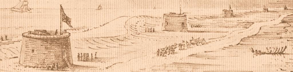
[See early 19th plan of the redoubt and the four batteries]
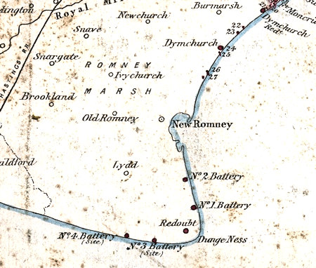
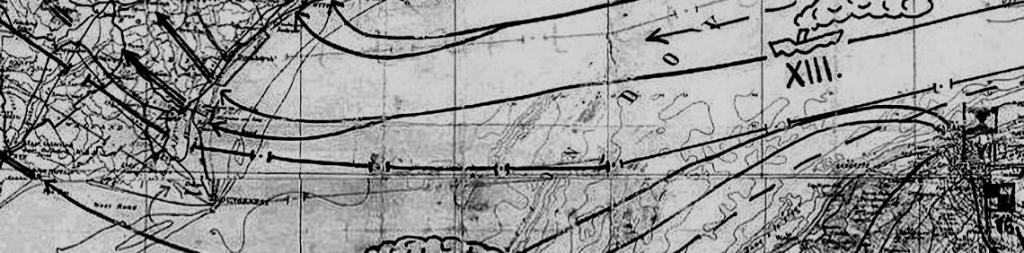
1867 map of the Dungeness Batteries and Redoubt.
Also showing location of the Martello Towers 22 to 27 and Dymchurch Redoubt
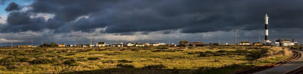
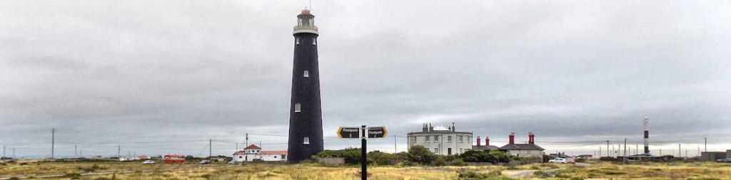
The Redoubt was located right at Dungeness Point, just hundreds of yards from the lighthouse(s).
The earthwork redoubt was built in 1798, an octagonal strongpoint built to support the four batteries built at Dungeness.
The Redoubt was about 215 metres in diameter and originally armed with eight 24-pounders mounted around the top of the ramparts (although another source states eleven).
In 1803 it was reported that it was not defensible against a swift direct assault, neither could it be made so at any moderate expense.
The raised earthworks can still be clearly seen, with a row of ex RNSSS cottages now built inside. The flattened counterscarp of Dungeness Redoubt is readily discernible from the top of the Old Lighthouse.
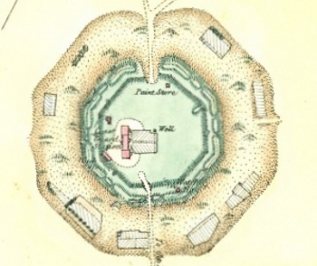
Plan of Dungeness Redoubt
Dungeness Redoubt
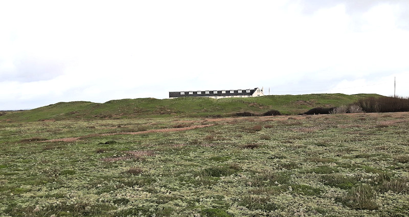
Dungeness Redoubt today (with the old RNSSS cottages within its boundary)
No.1 Battery was located about 2 miles north of the Redoubt, off the appropriately named Battery Road in Lydd-on-Sea.
Built in 1798 and modified in 1860, the battery was a self-contained triangular fort on a small scale. The top platform, slightly raised to give command of the sea, accommodated 4 or 5 24-pounders, and a brick loop-holed wall 3.5 metres high extended from the corners of the terreplein to form a sharp point at the rear.
The main entrance, guardroom and ancillary buildings were spaced along the exterior walls. In 1860 the battery was remodelled, receiving 1 x 7-inch breech-loader and 4 x 68 pounder smooth bores, all on traversing platforms. The battery was manned by 3 officers and 50 Non-Commissioned Officers and Privates.
Although disused by the end of the 19th century, it was anecdotally reoccupied in World War II given that two WWII period nissen huts were visible on the south-eastern side of the battery on aerial photographs of 1946.
The site of this battery still exists today, with some remains of the fortification and gun emplacements, whilst almost overgrown, clearly visible.
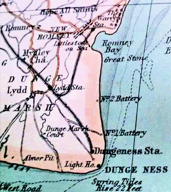
Bartholomews 19th Century Atlas Showing No.1 and No. 2 Batteries
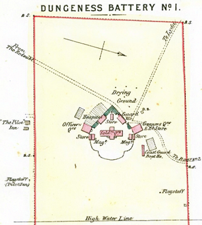
Plan of No.1 Battery in1867
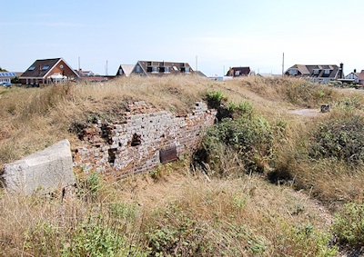
No.1 Battery Today
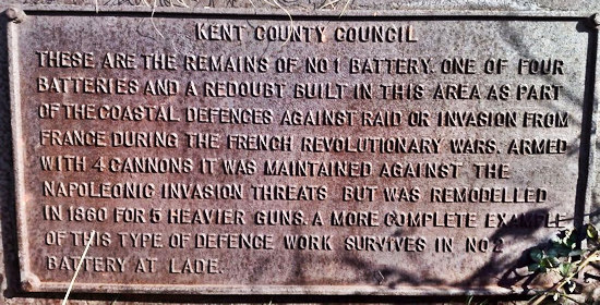
Plaque on Dungeness Battery No.1 See text below
KCC Plaque reads:
'These are the remains of No. 1 Battery one of four batteries and a redoubt built in this area
as part of the coastal defences against raid or invasion from France during the French revolutionary wars.
Armed with 4 cannons it was maintained against the Napoleonic
invasion threats but was remodelled in 1860 for 5 heavier guns.
A more complete example of this type of defence work survives in No. 2 Battery at Lade'
![]() Video of No.1 Battery November 2022
Video of No.1 Battery November 2022
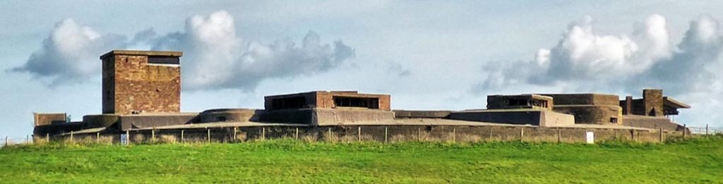
No.2 Battery, also known as Lade Fort, was located off the appropriately named Lade Fort Crescent in Lydd-on-Sea, about 1½ mile further north than No 1 Battery.
As built in 1798, No.2 Battery/Lade Fort consisted of an arc of four or five open emplacements for traversing guns to fire on the beach and anchorage. There was originally also a projection at the south-east corner of the battery. The enclosure to the rear included accommodation for the small garrison, a guardhouse and artillery store. At either extremity of the gun emplacements was a small magazine. The battery lost some of its command of the field of fire after the accumulation of shingle in front of the bastions. The battery was manned by 3 officers and 31 Non-Commissioned Officers and Privates.
In 1860 it was remodelled with slightly raised positions to mount one 7-inch breech-loader gun and four 68-pounder smooth-bore guns on traversing platforms. In the late 19th century Lade Fort was converted to use as a coastguard station. The battery was again occupied during the Second World War and several reinforced concrete pillboxes were built within the close vicinity.
During the period of the Coast Blockade Service (1816 to 1831) it was used as Coast Blockade and Signal Station, being manned 1 Officer, 4 Petty Officers and 18 men of the Royal Navy. In the late 19th, it was converted for use as a coastguard station and continued until the 1960s when a block of Coastguard houses and office were built in one corner. It was re-used during both World Wars as a site for anti-aircraft guns.
An Ancient Scheduled Monument, quite a lot remains at the site today, much of it overgrown with vegetation but some of the walls and the remains of a gun emplacement can be seen quite clearly. Despite some damage and alterations in the past, No.2 Battery/Lade Fort is a good example of a late 18th century coastal battery, which survives well. It is the only one known to survive of a series of eleven such coastal batteries built between Deal and Eastbourne. The walls are largely intact and the layout is well preserved, demonstrating well its purpose as an autonomous self-contained battery. The site will also contain archaeological evidence relating to the construction, use and history of the coastal battery.

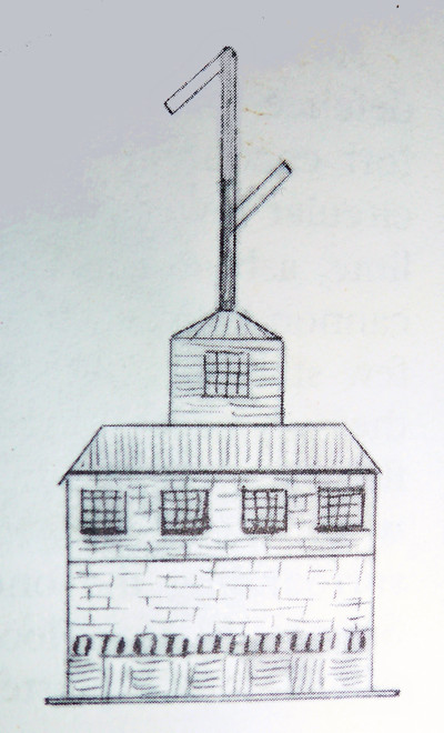
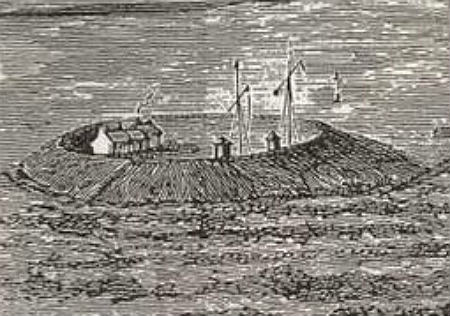
No. 2 Battery when a Blockade and
Signal Station with semaphore system in c1822
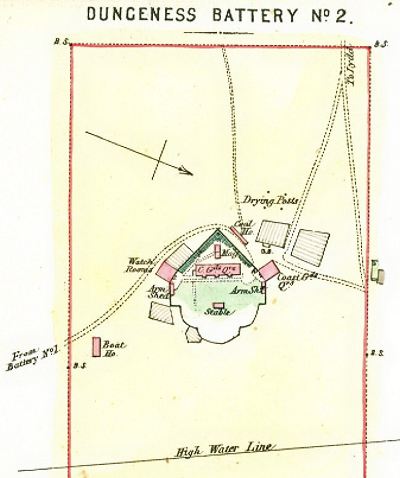
Plan of No.2 Battery (Lade Fort) in 1867
.jpg)
No.2 Battery Today (rear view)
These two batteries were located to the west of Dungeness point. The batteries, built in 1798, were self-contained triangular forts on a small scale. The top platforms, slightly raised to give command of the sea, accommodated 4 or 5 24-pounders, and a brick loop-holed wall 3.5 metres high, extended from the corners to form a sharp point at the rear.
The main entrance, guardroom and ancillary buildings were spaced along the exterior walls. Both were destroyed by the sea between 1818-1823.
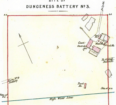
Plan of No.3 Battery in 1867
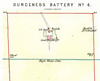
Plan of No.4 Battery in 1867

