Greatstone History
![]() Introduction
Introduction
![]() Greatstone at the Beginning
Greatstone at the Beginning
![]() Development of Greatstone
Development of Greatstone
![]() Photo Galleries
Photo Galleries
![]() 1930s Plans for Greatstone
1930s Plans for Greatstone
![]() 1948 Map
1948 Map
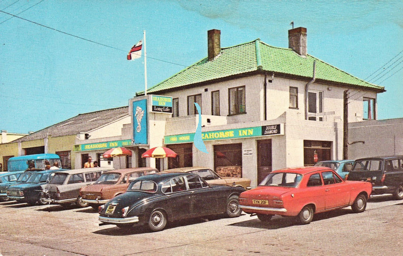
![]() Jolly Fisherman History
Jolly Fisherman History
![]() Lost Railway Station
Lost Railway Station
![]() US Bomber Crash 1944
US Bomber Crash 1944
![]() PLUTO
PLUTO
![]() Romney Hoy
Romney Hoy
![]() Sound Mirrors
Sound Mirrors
![]() Maddieson's Holiday Camp
Maddieson's Holiday Camp

The village of Greatstone is located on the south coast of Romney Marsh between Folkestone and Rye, about one mile east of New Romney.
Less than 200 years ago the village of Greatstone did not exist. As recent as 1816 the land on which the present village now stands was no more than just part of the seabed in Romney Bay, washed over by the tides of the English Channel.

c1800
c1900
c1908
1920s
1920s
c1920
1928
1931
c1935
1937
1944
1953
c1960
1962
1966
1967
1974
1977
1983
History Timeline
Greatstone did not exist; just part of the seabed
Greatstone 'uncovered' by the sea
The Old Jolly Fisherman pub built
Greatstone predominently sand dunes
Sound Mirrors built
Maddieson's Holiday Camp built
RH&D Greatstone Dunes station opened
Plans for the development of Greatstone
Current Jolly Fisherman pub built
Southern Railway Greatstone-on-Sea station opened
PLUTO
The first St Peter's Church built
Shops in Dunes Road built
Current St Peter's Church built
Lifeboat Station in Greatstone established
Southern Railway Greatstone-on-Sea station closed
Gravel Extraction form Greatstone Lakes
Present Lifeboat Station in Greatstone built
RH&D Greatstone Dunes station closed
New Romney lay at the inland side of the bay, the north entrance of which was marked Little Stone and the south entrance Great Stone. See 1816 Ordnance Survey map below right.
Greatstone is a recent name taken from a shoreline feature, since eroded by coastal changes, known as the Great Stone. See map right
Great Stone, as it was known in c1800, was just a shingle headland, being the land point that marked the southern entrance to the bay that extended almost as far west as New Romney. The sea had been retreating from New Romney, once a harbour and port, ever since the 13th century.
The same shingle headland existed in 1617. It was the northern extremity of the Dungeness shingle and was known as Stone Point/End. In about pre-1800 shingle moved south from Dymchurch (to the north of Greatstone, south of Hythe) and started to form a barrier to the sea.
This was know as Little Stone, which became the viilage of Littlestone.
Silt started to build up behind this barrier and in 1839 a wall was built to exclude the sea just to the north of the present Littlestone, which accelerated this silting process. Around 1900 a further sea all was built that resulted in the gap between Greatstone and Littlestone being closed.
This was the beginning of Greatstone. And for shingle read 'stone' as in Greatstone.
Prior to the 1920's there was hardly anything to Greatstone at all. In the 1920's the area was predominantly covered by sand dunes and was known as the Greatstone Dunes Estate. It consisted of just a few properties mainly used as holiday homes.
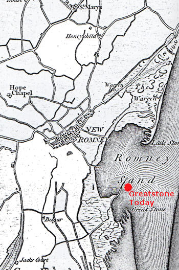
Map showing location of Greatstone in 1816
The area between Dunes Road and Littlestone road ie the northern 'half' of the present Greatstone, was mainly taken up as a golf course, the Greatstone Golf Club. In about 1926 their clubhouse was destroyed by fire which led to the demise of the club in 1931.
The dunes at Greatstone led straight to the sea and together with the fine sandy beach and safe bathing made for a popular holiday destination.
In 1931, given the potential for tourism and related residential population, local Littlestone builder and Cllr Mr C.E.Andrews had architect's plans drawn up to provide sites for over 1,370 residential properties in Greatstone.
You can read more about and see the plans for this development on our page 1931 Plans for Greatstone.
►
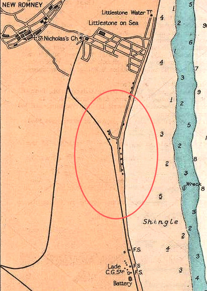
Greatstone in 1943 as shown on a chart
Dungeness, New Romney & Littlestone sea coast chart. Kent. ADMIRALTY 1943 map.
At that time Greatstone just comprised very few properties, the start of Dunes Road
and the start of The Parade towards Dungeness - see area enclosed in red.
Littlestone to the north was a little more developed than Greatstone and
all there was at Lydd-on_Sea was a Coast Guard station
located in what was Battery No.2 (Lade Fort)
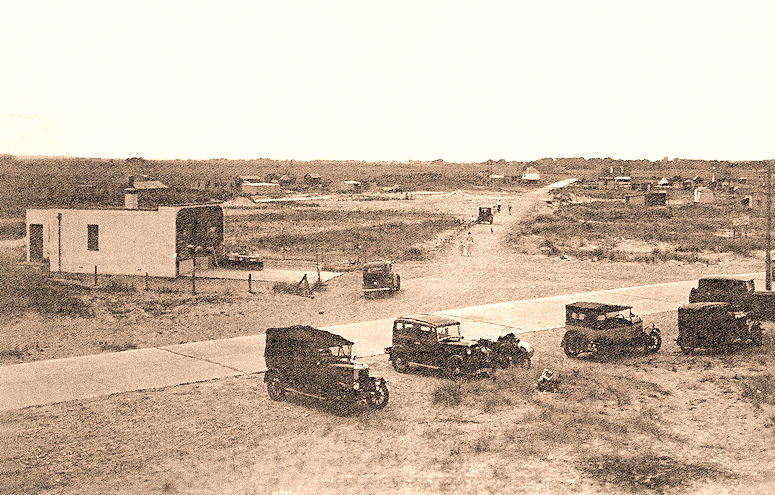
Junction of The Parade, Coast Drive and Dunes Road in the 1920s
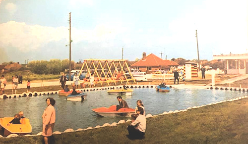
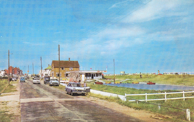
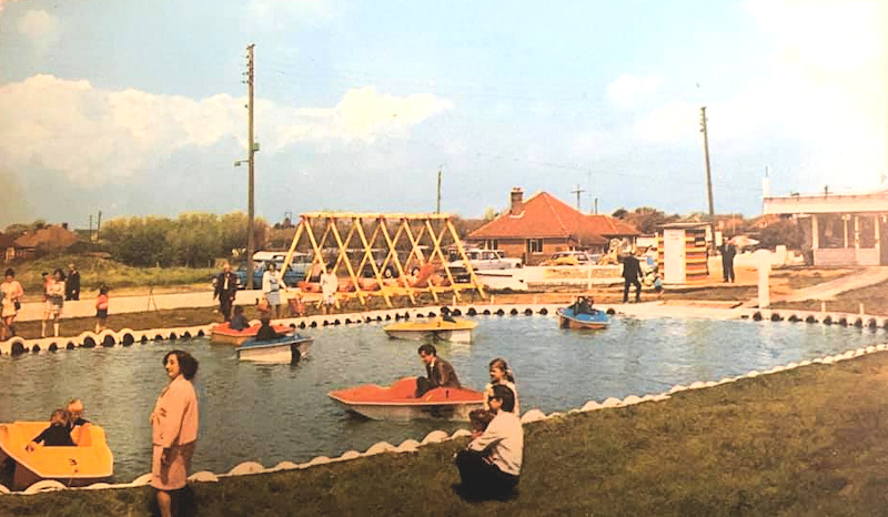
The old boating lake in Coast Drive in 1974.
The lake was in front of where the Varne Boat Club and Lifeboat Station are today
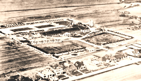
Before the Romney Sands Holiday Park there was Maddieson's Holiday Camp on the same site. Maddieson's started up in the 1920s and continued into the 1980s when the camp was sold. It was a large camp, covering some 12 acres and was an extremely popular destination for holidaymakers. You can get a very good idea of the size by looking at the pictures in the 1931 Plans for Greatstone.
The camp is now (2020) owned by Parkdean Resorts and still welcomes hundreds of holidaymakers each year.
Find out more about Maddieson's Holiday Camp's Facebook page.
Maddieson's Holiday Camp c 1950
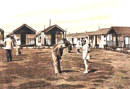
The Putting Green
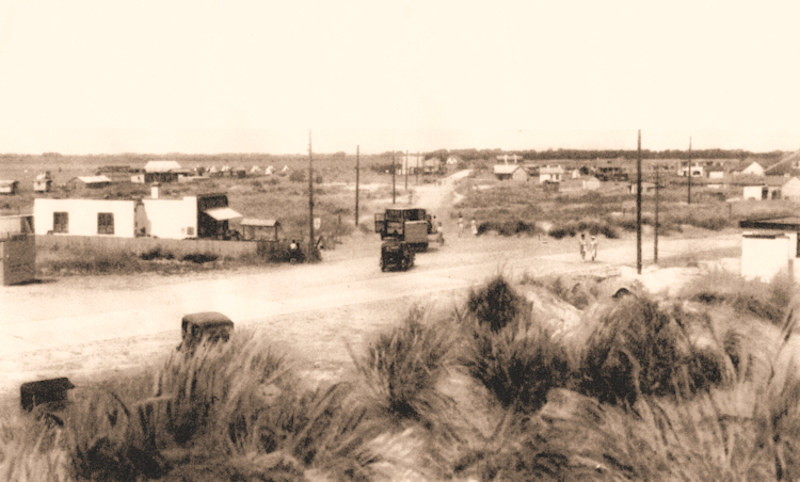
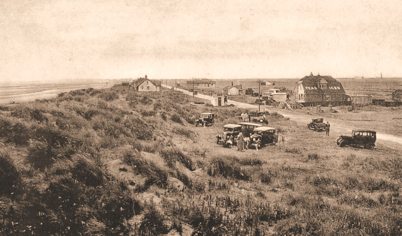
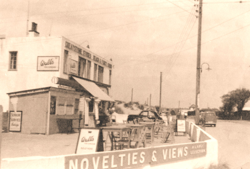
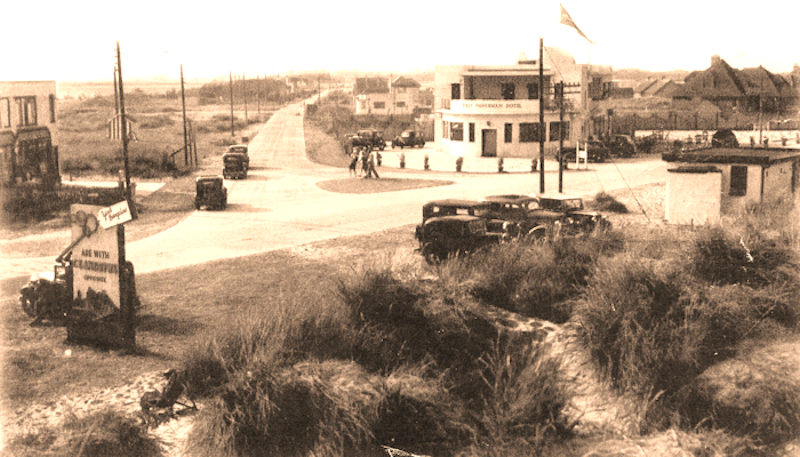
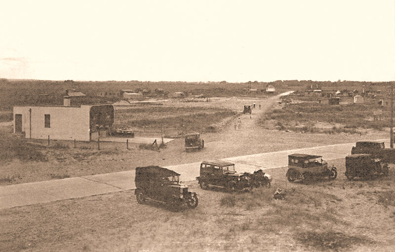
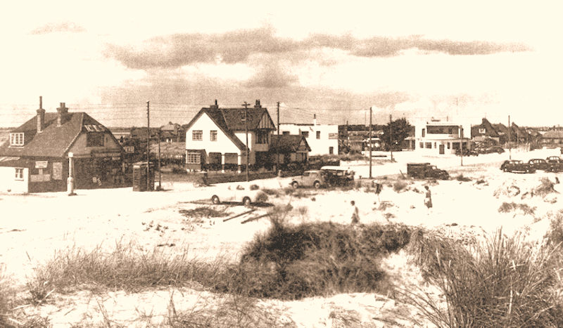

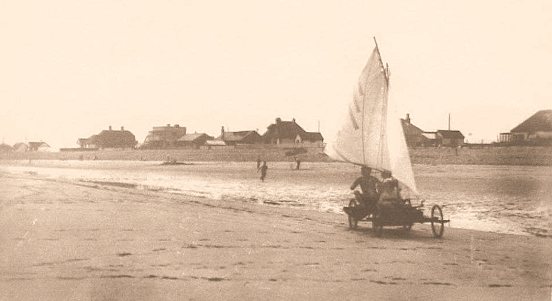

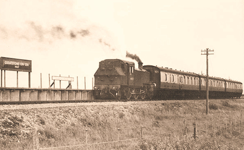

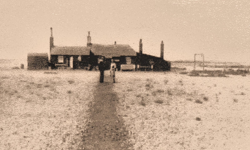

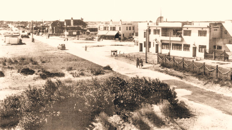
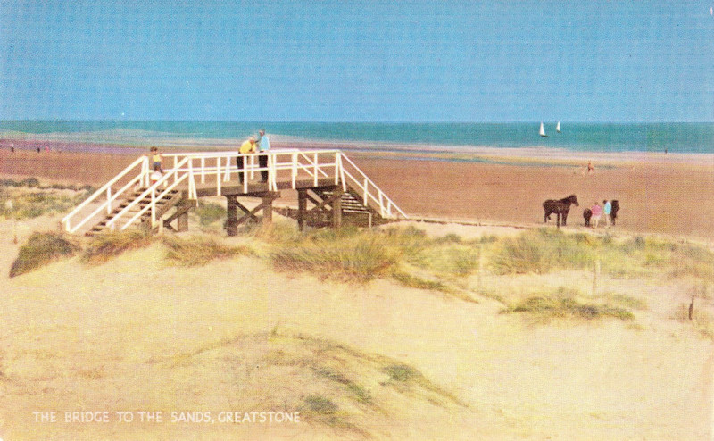
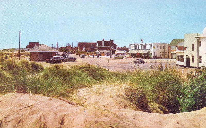
Photo Gallery - Greatstone in the 1960s in Colour