Introduction

Introduction Origin of the name 'Romney'
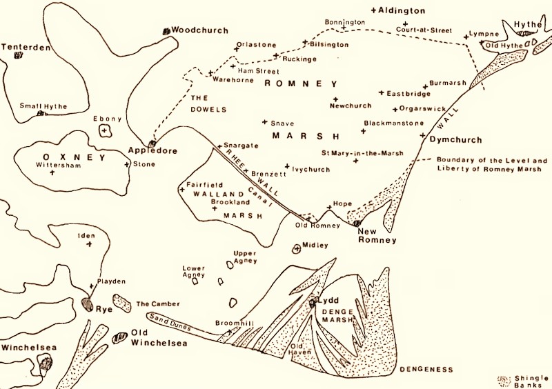
Romney Marsh is the largest coastal wetland on the south coast of England. With the English Channel as its eastern boundary, it is formed from several linked marshes: Romney Marsh proper forms the eastern portion, with the 'younger' Walland Marsh forming the majority of the western portion, and Denge Marsh to the south.
Despite these internal divisions, all three portions are now collectively known as Romney Marsh.
The Marsh has had a long and complex natural history of formation and alteration which has given rise to very variable geological deposits across its area.
Although fertile, the land relies on the constant upkeep of the drainage system and the massive earthen defence walls and natural shingle barriers to protect it from the sea.
Around 6000BC Romney Marsh did not exist. The land where Romney Marsh now is was some 40 feet (7m) lower than it is today and was covered by the sea. 1,000 years later, in 5000BC, farmers crossed the channel and introduced agriculture to Kent.
By 100AD things had changed dramatically. A large shingle and sand bank had built up with materials built up by wave action, known as longshore drift, from Hastings towards Hythe.
The marshes that developed inside the shingle banks gradually became dry land.

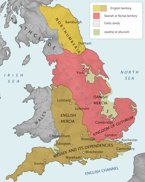
Britain in 878, showing Romney Marsh as 'Swamp or Alluvium'
Deposits of clay, silt, and sand left by the rivers flowing into the sea from the higher ground to the west, producing alluvium, fertile soil.
The Romans had invaded Britain from France 100 years before and had built 10 forts around the Kent coast to protect them from Saxon invaders.
The remains of a fort, Stutfall Castle, built by the Romans to protect a major port, can be found near Lympne over-looking what became Romney Marsh.
By the 13th century, over 15 Medieval Churches had been built. Also in the 13th century, wool, from the many sheep that had been on the Marsh for hundreds of years, became subject to export duty, leading to smuggling.
The smuggling increased in the 17th century when wool exports made illegal.
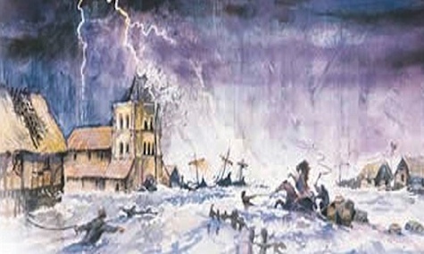
In 1287, a great storm hit the southern coast of England with such ferocity that whole areas of coastline were redrawn - the port of New Romney, that had stood by the sea, became landlocked, while others found themselves in possession of a new harbour.
In the 14th century, the Black Death devasted the population throughout Europe, with Romney Marsh being particularly affected, causing an increase in sheep farming.
In the 15th century, the installation of drainage and sea defences for the Marsh was formalised, providing proper magaement of the miles of drainage watercourses.
From 1564 the health of the Marsh population suffered from malaria, then known as ague or marsh fever, which caused high mortality rates until the 1730s.
Given its closeness to the continent, the flat hinterland and easily accessible beaches, Romney Marsh has always been vulnerable to invasion from across the English Channel, and the threat of invasion from France in first year of the 18th century was no exception.
The 20th century brought the first and Second World Wars with Germany, again making Romney Marsh the first line of defence from invasion across the channel.

The Great Storm at New Romney
(Artist's impression on the cover of the New Romney Town Trail leaflet)
Views of Old Romney Marsh


